Legal Challenges to Mapping in India #1 - Laws, Policies, and Cases
Responding to the draft Geospatial Information Regulation Bill and the draft National Geospatial Policy made public recently, this post provides an overview of the present configuration of laws, policies, and guidelines that provides the legal framework in India for governance of creation and sharing of geospatial data in India. The post also studies these policies in action by describing the key legal cases around the creation and use of geospatial data. The next post of this series will document the reflections and opinions of the key geospatial industry actors in India, as well as the free and open source mapping community.
1. Introduction
2. Mapping the Legal Journey of Geospatial Data: Past to Present
2.1. National Map Policy, 2005
2.2. Guidelines issued by Survey of India
2.3. Remote Sensing Data Policy (RSDP)
2.4. Civil Aviation Rules
3. Incidents of Legal Actions Faced by Agencies
3.1. Google's Mapathon in Legal Trouble
3.2. One Country - Two Boundaries
3.3. J. Mohanraj v Google and Others
4. Conclusion
5. References
1. Introduction
“Maps, like faces, are the signature of history.” – Will Durant [1]
Throughout the course of history geospatial information has played an important role in technological, economic, political and cultural dimensions of the human society. With technological developments taking place, the field of mapping – that is collection, analysis, and representation of geospatial data – is continuously evolving. On the face of it, creation of geospatial data seems to be an exclusive scientific and technological matter. However, the political and economic facets of geospatial data are often as predominant and complex as its scientific practice. Continuing from the colonial era, the political facet of mapping emerged significantly in the public discourse from the 1990s onwards as digital technologies amplified the ability of non-governmental actors to collect, generate, and share geospatial data, in the form of maps or otherwise [2]. This 'democratisation' of the ability to map and share private/user-generated maps structurally undermined the government's ability to have an authoritative and universal voice when it comes to geospatial depiction of the nation and its various components. Similar to the other upsurges in the digitized world, which is often followed by an introduction of legal provisions in order to keep access to and use of digital data under mechanisms of monitoring and permission, mapping in India has also has subsequently been governed under policies addressing both terrestrial mapping and remote sensing. Concerns of national security, naturally, have driven much of these policies.
This post focuses on providing an overview of the present configuration of laws, policies, and guidelines that provides the legal framework in India for governance of creation and sharing of geospatial data in India. The post also studies these policies in action by describing the key legal cases around the creation and use of geospatial data. The next post of this series will document the reflections and opinions of the key geospatial industry actors in India, as well as the free and open source mapping community.
2. Mapping the Legal Journey of Geospatial Data: Past to Present
“We know every inch of the nation, because we map every inch of it!” – Survey of India [3]
Aforementioned slogan adopted by the primary organization responsible for mapping all geospatial data in India indicates the importance of the geospatial data and mapping the same. While it indicates the importance of having access to mapping data in order to be aware of the geospatial features of one’s country, it also cleverly reveals the vulnerability that having access to mapped data brings. The phrase can be said to imply that mapping every inch of the country leads to information about every inch of the nation which is useful if in the hands of government agency but repugnant to security if in the hands of external agencies. This conflict between access to information about the country and the security concerns arising from such an open access has led to a rich evolution of legal policies governing the same.
Set up in 1767, Survey of India (hereinafter “SOI”) was required to map the terrains of India to fulfill the commercial and political convenience of the East India Company [4]. During these colonial times, maps were considered to be essential for governmental purposes and thus their dissemination to unauthorized persons was barred by Clause 5 of the Official Secrets Act, 1923 [5]. Thus, till 1950s mapping was being governed by the colonial provisions which maps restricted to official use only [6]. With independence, the functions of the SOI shifted mainly towards providing information for the defense forces [7].
An important change came in the form of orders and notifications by Ministry of Defence (hereinafter “MOD”) during 1960s, the major one being the 1965 order that permitted distribution of maps of scale 1:4 M [8]. The Map Restriction Policy of the MOD, however, imposed categorical restrictions on sharing of maps, aerial photos, and all geophysical data for various parts of India - with a focus on international border areas in the North-Eastern state, and the coastal zone that included several large cities like Chennai, Kochi, Kolkata, and Mumbai [9]. Dr. Manosi Lahiri notes that "[t]his had a far reaching effect on the mapping culture of independent India and perpetuated the perception among many that maps were a security threat" [10]." By 1971, however, the functions of SOI extended to catering to inter alia all development activities and was hence brought under the ambit of Department of Science and Technology [11].
However, the catalytic transformation came in the form of National Map Policy, 2005 which made SOI the nodal governmental agency for dealing with all processes involving geospatial data. While harping for open access to geospatial data, the policy accompanied by corresponding guidelines have largely restricted the power to map geospatial data to SOI. The Policy and the guidelines have been discussed in detail as under.
2.1. National Map Policy, 2005
The National Map Policy, 2005 (hereinafter, “NMP”) was announced by the Central Government on May 19, 2005 [12]. The preamble of the policy identifies the importance of high quality spatial data in various facets such as socio-economic development, conservation of natural resources, infrastructure development etc [13]. Topographic map database constitutes the foundation of all spatial data and its production, maintenance, and dissemination has been assigned as a responsibility to SOI, which is to "liberalize access" to spatial data without compromising upon security concerns. Thus, the conflict between national security and right to have access to information regarding one’s country is clearly highlighted in the policy as a need for enactment of the same. Thus, the policy objectives include access to National Topographic Database (NTDB) [14] and promotion of geospatial based intelligence, subject to confirmation to national standards of SOI.
In order to realize the security concerns, inter alia, a dual-classification was created amongst the maps, namely - i) Defence Series Maps (“DSM”) and ii) Open Series Maps (“OSM”). While the former constitutes of topographical maps that mainly cater to defence and security requirements of the country, the latter supports developmental activities. Hence, DSMs whether in analogue or digital form, fall under the classified category and the power to issue guidelines pertaining to their use vests digit mainly for developmental purposes, they are not openly accessible by ipso facto and need to gain the ‘unrestricted’ tag after clearance from MOD. A table specifying the distinction between DSMs and OSMs in detail has been provided below:
| Sub-Topic | Defence Series Maps (“DSM”) | Open Series Maps (“OSM”) |
|---|---|---|
| Why are these maps used? | The maps under this series cater to defence and security requirements of the country. | The maps under this series are useful in supporting various developmental activities in the country. |
| What are the technical classifications? | Everest/WGS-84 Datum and Polyconic/UTM Projection) on various scales (with heights, contours and full content without dilution of accuracy). | In UTM Projection on WGS-84 datum, bearing different map sheet numbers. (And as provided in Annexure B of the NMP) |
| Who can use these maps? | Maps (in analogue or digital forms) for the entire country will be classified. | Both hard copy and digital form will become “Unrestricted” after obtaining a one-time clearance of the Ministry of Defence. |
| How can the maps be used? | Guidelines regarding the use of DSMs will be formulated by the Ministry of Defence. | Guidelines regarding the use of OSMs will be formulated by SOI regarding aspects like procedure for access, further dissemination /sharing, ways and means of protecting business and commercial interests of SOI etc. |
While the DSMs are completely classified, restrictive provisions regarding usage and dissemination of OSMs have also been incorporated in the policy. OSMs are not allowed to show any civil and military Vulnerable Areas and Vulnerable Points (VA’s/VP’s). OSMs on a scale larger than 1:1 needs to be disseminated either by sale or an agreement, which will allow the agency to add its own value to the maps obtained, and to share these maps with others.
The primary transaction between SOI and the agency as well as all the subsequent transactions between the agency and other users have to be registered in the Map Transaction Registry for records. While the Map Transaction Registry forms an important part of the NMP, no such registry information has been made available on the official website of SOI as indicated by the screenshot below.
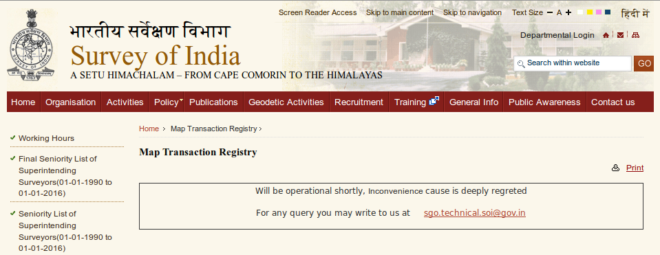
Map Transaction Registry, Survey of India, URL: http://www.surveyofindia.gov.in/pages/view/48
The policy allows users to publish maps on hard copy or web (with or without GIS interface) subject to a certification from SOI in case of depiction of international boundaries. The policy also upholds the validity of the previous MOD notifications pertaining to mapping subject to the modifications introduced by the policy and authorises SOI to issue further guidelines corresponding to the policy.
2.2. Guidelines issued by Survey of India
Under the powers vested by the NMP, SOI has issued detailed clarificatory guidelines in furtherance of the policy [15]. The restrictions arising on mapping of geospatial data can be attributed to two major factors namely, Security concerns and Copyright provisions [16]. Under the guidelines, copyright of both digital and analogue maps has been vested with the SOI. Penal consequences have been mentioned as a result of violation of SOI’s copyrights. In furtherance of security concerns, the guidelines uphold the Ministry of Finance (Department of Revenue) Notification No. 118-Cus./F.No.21/ 5/62-Cus. I/VIII dated 4th May 1963 which prohibits the export of all maps/digital data in 1: 250K and larger scales through any means. Digital Topographical data has been an exclusive licensing domain of only Indian individuals, organisations, firms or companies.
While paper maps can be accessed from SOI offices against payment of price, digitisation of maps has been strictly made forbidden by the guidelines. Ownership of digital data has been vested completely with the SOI and can only be gained against payment after application through a specified proforma.
2.3 Remote Sensing Data Policy (RSDP)
In 2011, the confusion pertaining to applicability of NMP to both territorial and satellite mapping was resolved with the release of the Remote Sensing Data Policy (RSDP). The policy recognized the importance of remote sensing data and noted that it was largely used by government and non-government users from Indian and foreign remote sensing satellites. However, again banking upon the need for security considerations, the policy was released with the purpose of “…managing and/ or permitting the acquisition/dissemination of remote sensing data in support of developmental activities" [17]. Department of Science (DOS) was made the nodal government agency for all actions pertaining to remote sensing data under the policy.
A basic perusal of the policy indicates a parallelism between the RSDP and the NMP. Thus, similar to NMP, RSDP assures of a government managed Indian Remote Sensing Satellites (IRS) Programme, the data produced by which will be solely owned by the government and other users could only be provided with licences if need be. Any attempt at acquiring and/or dissemination of remote sensing data within India requires permission through the nodal government agency. National Remote Sensing Centre (NRSC) of the Indian Space Research Organisation (ISRO)/ DOS is vested with the authority to acquire and disseminate all satellite remote sensing data in India, both from Indian and foreign satellites. NRSC is also supposed to maintain a systematic National Remote Sensing Data Archive, and a log of all acquisitions/ sales of data for all satellites. Thus, nodal government agencies were created for both terrestrial mapping and satellite imagery, former being SOI and latter NRSC.
2.4 Civil Aviation Rules
Aerial instruments and aircrafts act as important instruments for geophysical surveys and mapping. Thus, this area does not go ungoverned. While, till date, India doesn’t impose an explicit bar on foreign registered aircraft overflying its territory for aerial photography and geo-physical survey, the same is subject to prior clearance under rule 158 and 158A of the Aircraft Rules, 1937 on account of safety and security concerns, the procedure for which has been given under Civil Aviation Rules (CAR) [18]. CAR is applicable to inter alia agencies undertaking aerial photography, geophysical surveys etc. An application is required to be made as per Annexure E which inter alia requires confinement of photography/sensing to the exact area as applied and cleared by the Ministry of Defence. The application is forwarded by DGCA to the Ministry of Defence and other agencies responsible for issuing NOC.
DGCA’s restrictions extends to voluntary geographic information with prohibition of civilian drones in India. Unmanned drones are an important equipment used for the purpose of collecting geo-spatial data. The ban on flying drones in India exist from October, 2014 but is not in common knowledge [19]. While it is argued that drones could harm people and lead to chances of crashing, the major argument has always been the use of drones by anti-national elements to peruse sensitive places for plotting terror attacks [20]. While there is an ambiguity regarding using drones in India, flying drones over defence establishments and historical places is completely banned [21]. Thus, civilians using drones for clicking pictures of monuments etc. have often been confronted by the police [22].
Thus, there is no single policy that acts as a deterrent for mapping in India but an accumulation of multiple policies, guidelines and legal provisions that are used by departments of government to restrict mapping in the name of security. These restrictions have also witnessed incidents in their furtherance as detailed below.
3. Incidents of Legal Actions Faced by Agencies
Since the advent of restrictive mapping policies, numerous incidents have come forth when agencies have found themselves faced by legal actions for violating such policies. In recent times, these incidents were publicly highlighted in 1998 when the sale of the CD-Roms of Delhi Guide Maps created by Eicher were prohibited [23]. Eicher has been one of the oldest players of the private mapping market, creating city and road maps for India in the private sector for public distribution. While having faced a ban in earlier times, it is also one of the few companies been able to access the SOI data for value addition. It works in collaboration with SOI now, often launching products in ‘strategic alliance’ with them. After the implementation of NMP, we have witnessed two major legal controversies, both involving SOI on one hand and Google on the other.
3.1. Google's Mapathon in Legal Trouble
In furtherance of Google’s constant endeavour to have every nook and corner mapped, Google holds a competition called ‘Mapathon’ each year [2]. The competition invites people to map their local surroundings incentivised by lucrative prizes to winners. However, an initiative launched for purely mapping purposes had to face a large legal hurdle in the year of 2013. Google-Mapathon, 2013, held in February-March, had declared Vishal Saini as the 1st winner who had mapped the military-prone city of Pathankot. According to legal provisions governing mapping practices in India, civil and military Vital Areas (VAs) /Vital Points (VPs) cannot be shown on maps in public domain [25]. Thus, the tech-giant found itself amidst legal controversy for having held the competition without permission from Survey of India after a concern raised by BJP’s Tarun Vijay. A case was filed by SOI at the R.K. Puram Police Station. The primary contention was that the “Mapathon 2013 activity is likely to jeopardise national security interest and violates the National Map Policy. Citizens of the country, who are ignorant of the legal consequences, are likely to violate the law of the land” [26].
Considering the involvement of a U.S. based company, the investigation was handed over to CBI During the probe, it was alleged by then Surveyor General of India Swarna Subba Rao that Google did not refrain from “polluting” [27] the internet with classified material despite having been asked so. Further, then Additional Surveyor-General of India R.C. Padhi wrote claimed that “The Survey of India is only mandated to undertake ‘Restricted’ category surveying and mapping, and no other government/private organisations or any individual are authorised to do so” [28]. He told Reuters that some of the information provided by locals to Google could be ‘sensitive’ and the security of the nation could not be compromised at any cost [29].
Google on the other hand said that its primary motive was to map local information of daily needs such as hospitals, restaurants, markets etc. and the competition was in tandem with national laws. Further, it was heard that Google had been approached regarding Mapathon by SOI and it had replied with intimation of willingness to talk to SOI. However, SOI had not reverted back and Google was always ready and willing to talk out the matter. However, the much hyped case did not have a substantial result and CBI had to close the probe on account of lack of evidence [30].
Considered a thing of past, the controversy resurfaced in the recent times of January, 2016 post the Pathankot Air Base strike [31]. Google was dragged to the court for having displayed sensitive geospatial data regarding Pathankot that made possible an airstrike at the location. An injunction was sought to refrain Google from showing sensitive military areas and defence establishments on the maps made available by it. While the injunction was refused, Delhi High Court had asked the centre and the additional solicitor to look into the same and keep the court apprised. Thus, this can be termed as an open and unfinished matter ongoing legal contemplation.
While it is understandable that some areas are considered as vulnerable due to security concern. The lost keeps changing often leading to transgression into security places. But the major point being the list of vulnerable areas is classified and not released to public. In absence of such a list, how is it possible for google to vet its data to comply with security concerns.
3.2. One Country - Two Boundaries
Another major legal controversies in the field of geospatial mapping has been with regards to wrong depiction of international boundaries of India by Google. A basic perusal of the official website of SOI provides a list of only three documents under the tab of ‘Public Awareness’, all dealing with the crime of depicting wrong Indian boundaries [32]. While one of them includes the certified map with correct boundaries, to be complied with, other is a gazette notification bringing the Criminal Law Amendment Act, 1961 which criminalized the act of showing wrong depiction of boundaries. Section 69A of the IT Act has also been used earlier to restrict access to links depicting incorrect maps of India [33] though it only speaks about restricting public access to data, necessary in the interest of Sovereignty and Integrity inter alia, the section per se does not deal with dissemination of geos-spatial data.
It was in the year of 2014, that on the directions of Department of Science and Technology, SOI filed a complaint against Google at the Dehradun Police Station for depiction of international boundaries not in a “wrong manner” i.e. not in compliance with Government of India authentication [34]. The result was that today Google shows different boundaries on Indian domain, in compliance with SOI and different on International domain.
Google was also involved in a controversy when in 2009, Google maps for India marked areas of Arunachal Pradesh, including its capital Itanagar and Tawang, in China [35]. It was followed by an apology from Google and an immediate rectification for Indian users. However, Google uses a different version for China and the world creating disparity in the boundary depiction [36].
Google has not been the only platform having faced the anger of Indian community for wrong depiction. In 2011, copies of the Economist Magazine were seized for having depicted the map of Kashmir divided between India, Pakistan and China [37]. For similar reasons, Al-Jazeera was taken off air by the Indian government after a 5-day ban imposed under Section 69A of the IT Act [38]. Modi’s visit to Queensland University of Technology was accompanied by an “unqualified apology” from the authorities for having depicting Indian map without portions of Kashmir [39]. Urban Development Department of Bihar also ended up show-causing one of its employees for putting up wrong map on its website and substituting the same with SOI’s version after media attention [40]. India seems to be the country often having been angered due to wrong depictions of maps.
While India seems to be actively involved in Geo-politics, it isn’t the only country Google has fallen in legal trouble with, for wrongly depicting International Boundaries. In 2010, Google gained a lot of media attention for allegedly starting the ‘First Google Maps War’ [41]. It occurred when a Nicaraguan official led his forces to the Costa Rican territory on other side of the customary border and used Google Maps as a proof to deny trespassing. Nicaragua and Costa Rica have a long territorial dispute and Google seem to have fuelled it by depicting the Nicaraguan version of border according to which that area of Cost Rican territory came within the boundaries of Nicaragua [42]. Despite Nicaragua’s petition to Google to not accept Costa Rica’s petition to shift borders, Google voluntarily changed its borders to comply with the Costa Rican stance [43].
Another such incident followed in the case of Google’s depiction of Dutch-German border with respect to Dollart Bay [44]. Germany claimed the border to be closer to Dutch land while Dutch claimed it to be more towards centre. Google, however, chose to depict a self-version that transferred the German city of Emden to the territorial control of Netherlands. This infuriated the city which resorted to expressing its displeasure and asking Google to change the depiction. Google, this time, however remained dormant and no amendment in the depiction of Dutch-German border could be witnessed.
At the time of Crimean referendum supporting independence, U.N. had passed a resolution condemning the same and supporting territorial integrity of Ukraine. Google, however, believed in the contrary and was quick to bring changes into its maps to depict formation of independent Crimea [45]. Rather than a mistake, this time, Google had adopted a stance against the UN resolution and used its maps to vocalize the same.
Similarly during the inclusion of South Sudan in the U.N.G.A., while members voted, they were unaware of the exact territorial division between North and South Sudan. It was then that Google initiated the process of collecting geo-spatial information regarding South Sudan from locals in order to better the territorial integrity [46].
Thus, Google has times and again fallen into criticism for wrong depiction of international boundaries and even varied depictions of boundaries as per the perspective of the political entity. However, “Popularity does not bestow authority” [47] and Google’s maps cannot be accurately relied upon for proving sovereign territorial holds. Thus, most of the international incidents have witnessed countries resorting to peaceful petitions to Google informing it regarding the inaccuracy of the border and requesting a shift in the same. Hardly has the world witnessed penal provisions being invoked against Google for depicting versions other than the perceived ones.
3.3. J. Mohanraj v Google and Others
Apart from the above two incidents, another pertinent case is the 2008 judgment by the Madras High Court in J. Mohanraj v (1) Secretary To Government, Delhi; (2) Indian Space Research Organisation, Bangalore; (3) Google India Private Limited, Bangalore . A writ petition was filed by Mohanraj seeking a complete ban on Google Earth and ‘Bhuvan’; mapping initiatives by Google and ISRO respectively [48].
The petition was allegedly filed in public interest considering the security apparatus of Indian Government along with the threat posed by the terrorists. The petitioner claimed that the initiatives such as Google Earth used high quality satellite imagery to display bird’s eye view of various establishments including minute details and were bound to cover defense establishments and sensitive areas, posing a threat to Indian security. Dr. A.P.J. Abdul Kalam’s speech was referred to indicate his views against such open creation of geospatial data. The provisions of the NMP was highlighted and it was alleged that such mapping practices violated the individual rights of a person under Article 21 of the Constitution. Further, it was claimed that such practices could only be taken up by SOI and were outside the purview of private organizations.
However, the Court held that the petitioner was unable to produce any specific “Guidelines/Rules/Law laid down by the Central/State Governments, prohibiting the private organisations or any other individuals to Interactive Mapping Program, covering vast majority of the Planet”. Since the court could only interpret existing provisions and not lay down guidelines, passed the judgment against the petitioners.
From the above explained incident it seems that the NMP per se does not refrain creation of mapping data by agencies other than SOI. The centre of the conflict seems to lie with the interpretation of the policy by SOI claiming itself to be the exclusive agency entitled to map data. Hence, often though complaints and cases are filed against such activities, no concrete consequence emerges from the same. Further, the courts have also neglected the grievance of the issue and given ambiguous judgments in most cases. Thus no judicial sanction or opposition to the SOI’s guidelines exist till date often allowing SOI to continue with following its own version. While these cannot be termed as a solution, they definitely indicate towards the root of the problem.
4. Conclusion
It can be concluded from above compilation of legal provisions and incidents that it is perhaps SOI’s interpretation to NMP that gives rise to exclusive authority to map geospatial data and not the policy per se. The objective of the policy clearly advocates for promotion of the use of geospatial knowledge and intelligence. More than one provision under the SOI guidelines indicate towards the arbitrary abuse of power. First, a provision regarding ‘Settlement of disputes’ has been included in the guidelines. Secretary, Department of Science & Technology has been vested with binding decision making powers in case of a dispute on the applicability or interpretation of the guidelines between the SOI and any other person. Thus, instead of a judicial forum, an executive authority has been vested with quasi-judicial powers. Such a dispute resolution mechanism cannot be considered as devoid of bias towards the governmental agency, hampering fair and equal justice. Second, SOI assumed the power of mapping data but under the guidelines considers itself devoid of complete responsibility for the loss caused to any person on account of failure of proper dissemination of data. Third, the SOI has reserved the right to add, delete, modify or amend every provision of the guidelines at any time without assigning any reason or notice.
While depiction of wrong boundaries has been specifically been criminalized and can be accepted as symbolic of sovereign hold over contentious territorial areas, it hardly fulfills a security purpose other than acting as a proof to the international community. The incident regarding Mapathon, on the other hand, though did not result in penal consequences towards Google, seem counterproductive in the first place for asking for a ban on increase of geospatial resource data. Considering the same, prudency demands that India also adopt policies and measures that are more peaceful and accommodating in nature such as resolving territorial matters by talking out with Google and other agencies. The current and proposed stringent penal provisions only act as dis-incentivising measures for geo-spatial agencies to map India, which is not the motive sought to be achieved by the bill.
However, the interpretation of the policy cannot be blamed alone for restrictions such as depiction of VAs and VPs have been specifically mentioned in the policy. Above mentioned policies and guidelines have often been criticized for being overly restrictive in nature and a consequence of colonial hangover. In times of crowdsourcing of mapping data, the need of the hour exist in critically analysing the existent policies and their interpretation. The same is especially so in the absence of a high quality digital version of the correct boundary of India. While a map in PDF form has been put up by Survey of India, the same cannot be converted to digital form to be complied with or used to resolve territorial disputes of detailed nature. This makes it absolutely impossible to completely comply with the Indian version of the boundaries without a proper resource acting as a comparison check. The need of the hour is for the Government to release less ambiguous and specific details as to what it considers to be outside the scope of private mapping and the correct boundaries along with a less stringent policy framework so that India can protect its security, sovereignty and integrity while promoting creation and dissemination of geo-spatial data.
5. References
[1] SV Srikantia, 'Restriction on maps: A denial of valid geographic information,' [2000] 79(4), Current Science 484.
[2] Fatima Alam, 'Mapping the politics of cartography,' Infosys Science Foundation, 31 March 2015, http://www.infosysblogs.com/infosysprize/2015/03/mapping_the_politics_of_cartog_2.html, accessed 11 May 2016.
[3] 'About Us,' Survey of India, http://www.surveyofindia.gov.in/pages/view/10-about-us, accessed 11 May 2016.
[4] Ibid.
[5] R Ramachandran, 'Public Access to Indian Geographical Data,' [2000] 79(4) Current Science 450.
[6] Ibid.
[7] Supra, 4.
[8] “Scale represents the relationship of the distance on the map/data to the actual distance on the ground. Map detail is determined by the source scale of the data: the finer the scale, the more detail.” Seen at http://gif.berkeley.edu/documents/Scale_in_GIS.pdf.
[9] Dr. Manosi Lahiri, 'Survey & Mapping in India: The Regulatory Framework,' Directions Magazine India, https://www.mlinfomap.com/Pdf/Survey&Mapping-Lahiri%202.1.pdf, accessed 11 May 2016.
[10] Ibid.
[11] Supra, 2.
[12] ‘Guidelines for implementing National Map Policy,’ Survey of India, http://surveyofindia.gov.in/files/nmp/Guidlines%20for%20Implementing%20National%20Map%20policy.pdf.
[13] 'National Map Policy, 2005, Preamble,' Survey of India, http://surveyofindia.gov.in/files/nmp/National%20Map%20Policy.pdf.
[14] Ibid, Objectives.
[15] Supra, 11.
[16] Supra, 5.
[17] 'Remote Sensing Data Policy, 2011,' National Remote Sensing Centre, Indian Space Research Organisation, http://www.nrsc.gov.in/Remote_Sensing_Data_Policy.
[18] Civil Aviation Requirement Section 3 Air Transport Series ‘F’ Part I Issue I, 12th October 2010.
[19] Nandagopal Rajan, 'Why India needs rules for flying drones, soon' (The Indian Express, 9 July, 2015) http://indianexpress.com/article/technology/gadgets/why-india-needs-rules-for-flying-drones-soon/ accessed 11 May 2016.
[20] TNN, 'Now, flying a drone can land you in prison' (The Times of India, 15 February, 2016) http://timesofindia.indiatimes.com/city/jaipur/Now-flying-a-drone-can-land-you-in-prison/articleshow/50990613.cms, accessed 11 May 2016.
[21] Ibid.
[22] Supra, 19; 20.
[23] Supra, 5.
[24] tech2 news staff, 'Why is Google’s Mapathon in hot waters in India? All you need to know' (Tech-2, 12 Aug, 2015) http://tech.firstpost.com/news-analysis/why-is-googles-mapathon-in-hot-waters-in-india-all-you-need-to-know-228810.html, accessed 6 May 2016
[25] Supra, 12.
[26] Supra, 24.
[27] ‘PTI, 'Google ‘polluted Internet’ with classified material: Survey of India' (The Hindu, 10 August, 2014) http://www.thehindu.com/sci-tech/technology/internet/mapathon-2013-row-google-polluted-internet-with-classified-material-says-survey-of-india/article6300853.ece, accessed 11 May 2016.
[28] Sandeep Joshi, ‘Google didn’t take permission for Mapathon’ (The Hindu, 24 April, 2013) http://www.thehindu.com/news/national/google-didnt-take-permission-for-mapathon/article4648589.ece, accessed 6 May 2016.
[29] Supra, 24.
[30] Abhishek Sharan, 'CBI may close probe against Google in Mapathon case' (Hindustan Times, 12 February, 2015) http://www.hindustantimes.com/india/cbi-may-close-probe-against-google-in-mapathon-case/story-CgZYWoP9NgYA3xVepjr5bN.html, accessed 6 May 2016.
[31] PTI, 'Pathankot attack: Sensitive sites on Google Maps under Delhi HC scanner' (Times of India, 15 January, 2016) http://timesofindia.indiatimes.com/tech/tech-news/Pathankot-attack-Sensitive-sites-on-Google-Maps-under-Delhi-HC-scanner/articleshow/50596143.cms, accessed 6 May 2016.
[32] ‘Public Awareness,' Survey of India, http://www.surveyofindia.gov.in/pages/display/190-public-awareness), accessed 6 May 2016.
[33] Aman Sharma, '7-year jail, Rs 100 crore fine soon for showing PoK, Arunachal as disputed' (The Economic Times, 05 May 2016) http://economictimes.indiatimes.com/news/politics-and-nation/7-year-jail-rs-100-crore-fine-soon-for-showing-pok-arunachal-as-disputed/articleshow/52117889.cms, accessed 6 May 2016.
[34] Jaspreet Sahni 'Survey of India files complaint against Google maps for wrong depiction of India's boundaries' (News18, 13 December 2014) http://www.news18.com/news/india/survey-of-india-files-complaint-against-google-maps-for-wrong-depiction-of-indias-boundaries-731101.html, accessed 6 May 2016.
[35] Itanagar agencies, 'Arunachal fumes over wrong map on iPhone4' (Deccan Herald, 04 October, 2010) http://www.deccanherald.com/content/101784/F, accessed 6 May 2016.
[36] CC, 'How Google represents disputed borders between countries' (The Economist, 04 September, 2014) http://www.economist.com/blogs/economist-explains/2014/09/economist-explains-1, accessed 6 May 2016.
[37] The Kashmir Walla, 'Ten Maps of Kashmir That Angered India' (The Kashmir Walla, 14 May, 2015) http://thekashmirwalla.com/2015/05/ten-maps-of-kashmir-that-angered-india/accessed 11 May 2016.
[38] Ibid.
[39] Ibid.
[40] Ibid.
[41] Frank Jacobs, 'The First Google Maps War' (The New York Times, 28 February, 2012) http://opinionator.blogs.nytimes.com/2012/02/28/the-first-google-maps-war/, accessed 11 May 2016.
[42] Ethan Merel, 'Google’s World: The Impact of "Agnostic Cartographers" on the State-Dominated International Legal System' [2016] Columbia Journal of Transnational Law 442-444.
[43] Ibid.
[44] Europe, 'Google map gives German harbour to Netherlands' (BBC, 23 February, 2011) http://www.bbc.com/news/world-europe-12558741, accessed 11 May 2016.
[45] Supra, 42, 448.
[46] Ibid, 449.
[47] Supra, 47.
[48] J. Mohanraj v (1) Secretary To Government, Delhi; (2) Indian Space Research Organisation, Bangalore; (3) Google India Private Limited, Bangalore, 2008 Indlaw MAD 3562.
6. Author Profile
Adya Garg is a law student at West Bengal National University of Juridical Sciences, Kolkata and has completed her second year. An ardent *SRK fan*, and a dancer at heart, she loves reading books in her free time. Always excited about exploring new fields, she never misses an opportunity to work on areas outside her legal curriculum.
Author

