Draft Law Would Prohibit Showing ‘Disputed Areas’ on Maps of India
Maps that label geographic areas of conflict as “disputed” territories in India could put one behind bars for seven years with 1B Indian Rupees (US$15M) penalty if a recently proposed bill becomes law.
The article was published in Global Voices on May 11, 2016.
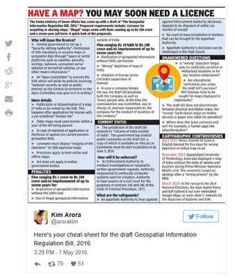
The controversial bill, also known as Geospatial Information Regulation Bill 2016 would make it illegal to “depict, disseminate, publish or distribute any wrong or false topographic information of India including international boundaries through internet platforms or online services or in any electronic or physical form.”
If approved, it could put large corporations like Google (with its Google map), free and open source projects like Wikipedia and Open Street Map, and several other organizations in trouble for showing areas of conflict as disputed. Pakistan-Occupied Kashmir (PoK) and Arunachal Pradesh near the China border are two well-known examples of such areas.
The Indian government ruled by Bharatiya Janata Party (BJP) under the leadership of Prime Minister Narendra Modi has been quite critical of the depiction of the PoK and China border in Arunachal Pradesh.
If passed in the parliament as law, it could prevent Indians and foreigners, government employees and people traveling in ships and aircrafts that are registered in India, to acquire geospatial imagery or data. To acquire such data, one needs to obtain permissions from the security vetting authority.
In recent years, the Indian government has targeted numerous foreign publications including Al Jazeera for showing distorted maps of India that excluded parts of the state of Jammu and Kashmir and even another state Arunachal Pradesh. While the bill does not explicitly mention these efforts, it seems to fall in line with these previous attempts to control the free flow of geospatial information.
A news article about the proposed bill published on the portal MediaNama explains how the potential law could affect map portals like Open Street Map and Google Maps, taxi, e-commerce and public safety sites and many other services that allow marking and sharing coordinates. “Most digital photographs contain location meta-data, and by sharing your photos online, you’re adding to a repository of data related to man-made phenomenon,” suggests the same article. Open data advocates also have published list of 25 different services, seven major news portals, and 14 nonprofits that would be affected if the bill is approved.
The Open Data community of India also has come up with a campaign “SaveTheMap” to draft a request to the government to not pass the bill. The draft request states:
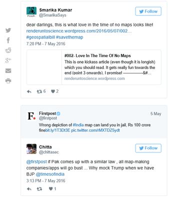
There has been a lot of discussion with hashtag #GeoSpatialBill and humorous comments on social media:
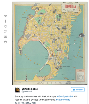
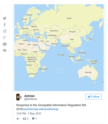
Many have already started tweeting with the hashtag #savethemap:
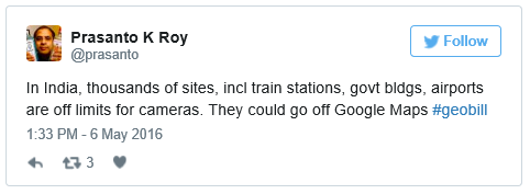
Twitter user Prasanto Roy explained the implications of geospatial bill for various companies including Google, Uber and Open street maps:
Here's what other experts have to say:
Arup. R writes in Geospatial World:
Arup. R writes in Geospatial World:
This Act needs to be dropped. In its attempt to cover all bases it has been made so broadband and all encompassing that it may actually impede the progress of work on Geospatial systems and therefore on key Government programmes and projects. The Act does not take into account the fact that with the advent of the Cloud, Data as a Service, Software as a Service and Platform as a Service there is no need for ‘persons’ to possess data. They can just access data, do their work and retain only the final results. This Act does not, in fact cannot, even begin to comprehend the paradigm shift in geospatial technologies which makes it a non-starter.
India does need a Geospatial Information Act, but it has to be an enabling and encouraging Act that makes for faster and better implementation of programmes, not a regressive and punitive Act as the proposed one.
Devdutta Tengshe writes about the overreaching ambit of Geospatial bill on Medium:
Worst of all, it (the bill) is trying to implement Security by Obscurity, which is expecting the country to become secure by hiding information from its citizens. This is dangerous, because the real mischief creators, be they terrorists, Foreign government agencies, or domestic criminals, will most likely have access to kind of data from foreign sources, and will not even think about getting permits and licenses from these Indian Authorities.
Cyber law expert Pavan Duggal told The Wire:
The draft legislation has the intrinsic problem that it has been given extra-territorial applicability in terms of jurisdiction. It is applicable to any person anywhere in the world. We have historically seen that such jurisdiction does not work well in practical terms. What if global players do not want to take your licence or subject themselves to your jurisdiction?
Duggal further spoke about how the law could impact the growth of e-commerce and m-commerce in India.
Under this law, Google Maps will be illegal without a licence, which means that all mobile or e-commerce applications working on Google Maps will also become illegal. The licence will also only be applicable to the concerned person. So if I am a taxi aggregator like Ola or Uber, I will have to get a separate licence over and above what Google Map has.
Indian Express calls the Geospatial bill a death note for Cartography:
The draft Geospatial Information Regulation Bill of 2016 is so perfectly ridiculous that one can only hope that it falls off the map before it can be tabled in the House. Publishers the world over have learned, to their bewildered amusement, that India censors maps of itself. Now, to strike fear into their anti-national gizzards, the government has invoked an official map censor, a babu-led organisation whose prior permission will be required to publish geospatial information, which is newspeak for maps. Failure to correctly depict the borders of India could attract a fine of up to Rs 100 crore, before the poor offending bozo is dragged away to the cooler for seven years. With this draft, the government has embarked on a journey without maps, which must rapidly become directionless.
Not the first time around?
Meanwhile, this clearly isn't the first time that services such as Google Maps have come under the federal scanner in India. In 2014, India's prime investigation agency Central Bureau of Investigation (CBI) had launched a probe into Google Maps’ irregularities in Mapathon 2013 and had accused the company of running the competition without procuring proper governmental permissions. But the agency had called off the case citing lack of ‘adequate evidence to corroborate the allegations’.

